The National Weather Service Newport/Morehead City forecast office has released specific details on what the Outer Banks might experience when Hurricane Dorian arrives.
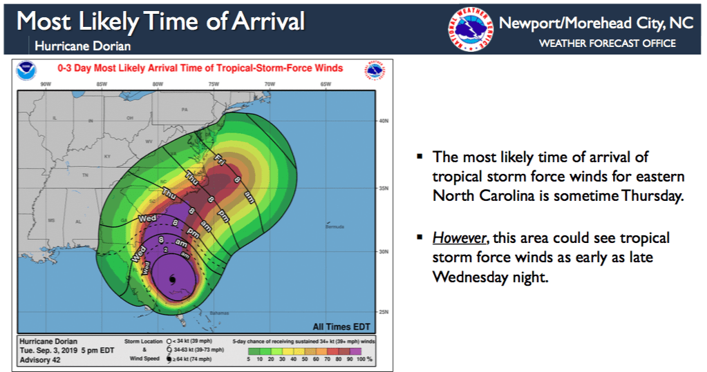
The storm is expected to move up the southeast coast Wednesday, approaching the North Carolina coast Thursday and Friday.
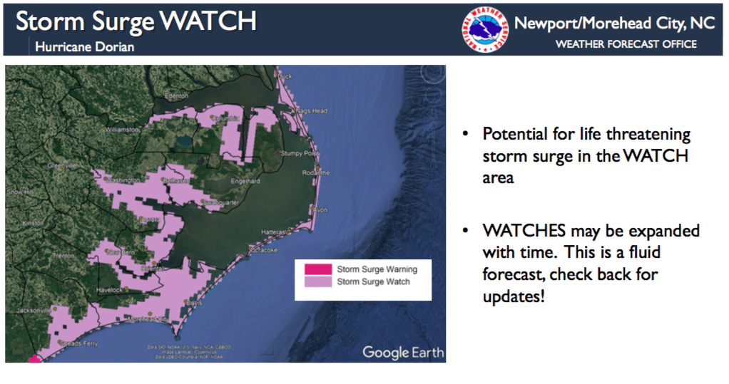
Hurricane and storm surge watches are in effect for the entire Outer Banks, as well as all of mainland Hyde, Dare and Currituck counties.
The hurricane’s strongest winds are expected Thursday night into Friday morning, with tropical storm force winds developing as early as Wednesday night. Winds are expected to peak Thursday evening into early Friday morning.
For Hatteras and Ocracoke islands, the weather service says winds will be the equivalent of a Category 1 hurricane. The peak wind forecast calls for 70-90 mph sustained winds with gusts to 115 mph.
For the northern Outer Banks, peaks winds are forecast at 45-60 mph, with gusts up to 75 mph.
For Currituck County’s beaches, peak winds are forecast at 45-55 mph with gusts to 75 mph.
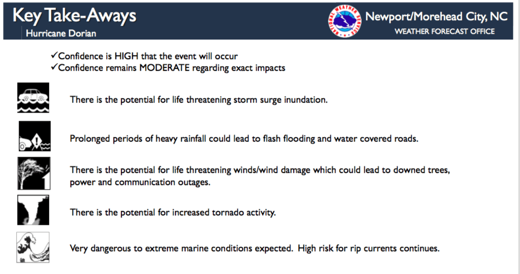
Storm surge watches are also in effect for much of the Outer Banks, with inundation of 3 to 5 feet is expected oceanside from Cape Lookout north to Duck, the weather service said.
For the inland sounds and rivers including the Pamlico Sound, Albemarle Sound, Alligator River, Neuse River, Pamlico River, 3 to 5 feet of inundation is expected.
“A small shift in the track could change what locations may see the most significant inundation,” forecasters said.
Very high surf and large breaking waves will likely result in moderate to significant beach erosion and ocean overwash along the North Carolina coast Thursday and Friday.
Overwash and sound side flooding will likely cause issues on Highway 12 on the Outer Banks Thursday and Friday. Vulnerable areas could experience erosion at multiple high tide cycles.
Current rainfall predictions for eastern North Carolina range from five inches further inland to more than 15 inches along the coast.