The National Weather Service issued a storm surge warning for the Outer Banks, and we remain under a tropical storm warning ahead of Tropical Storm Isaias.
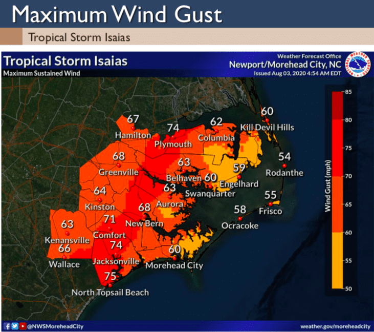
The latest peak wind forecast predicts 35-45 mph sustained winds and gusts up to 60 mph expected. The highest winds will be early Tuesday morning through Tuesday afternoon.
Tropical Storm Isaias is expected to make landfall somewhere along the North Carolina/South Carolina border. Ocean overwash on Hatteras Island and severe soundside flooding for the towns north of Oregon Inlet are possible.
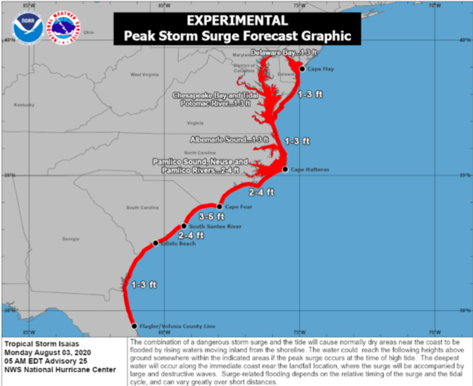
“Local NWS folks are thinking levels may reach 2-4 feet above ground as shown on their Storm Surge Threat slide,” Dare County Emergency Management Director Drew Pearson said Monday morning. “Iasias will bring impacts to Dare and now is the time to complete preparations. Ocean conditions will worsen and tornadoes remain a possibility. Keep the cell phones changed and on tonight with public safety alerts turned on.”
Water levels along the sound are already high in many places, particularly from Manteo to Kitty Hawk. Expect soundside flooding in low lying areas, at spots that are impacted by southerly winds.
8/3/2020 920 AM UpdateMore on Isaias: https://www.weather.gov/media/mhx/LatestBriefing.pdf
Posted by US National Weather Service Newport/Morehead City NC on Monday, August 3, 2020
The latest update includes the following potential impacts and timing information:
-
- Increased swell is producing very dangerous swimming conditions now through early next week. A ban on ocean swimming is in effect south of Oregon Inlet.
- Tropical storm force winds possible as early as Monday evening, but most likely sometime late Monday night or early Tuesday morning. Potential for strong tropical storm force winds, power outages, downed trees.
- Increased threat for tornadoes which can occur well ahead and away from storm center. May occur when people are sleeping, shorter advanced warning.
- Storm surge forecast is currently 2-4 feet.
- Potential for flash flooding especially inland. Minor river flooding possible late in the week.