A slow moving cold front is forecast to move across eastern North Carolina, bringing the potential for a very windy and very wet Thursday for the Outer Banks.
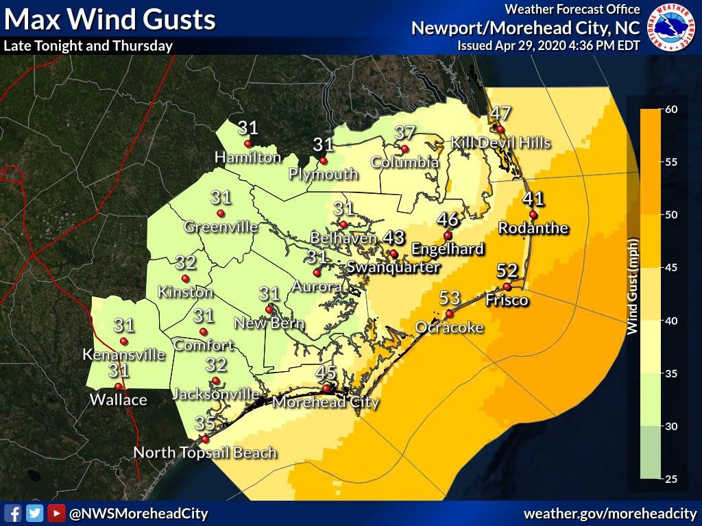
Strong southerly winds ahead of the front will result in gale force winds over the coastal waters and sounds with gusts up to 50 mph possible along the immediate coast, according to the National Weather Service Newport/Morehead City office.
An isolated damaging wind gust and a brief tornado will be possible in the strongest thunderstorms. Heavy rainfall with amounts in excess of two inches in spots will result in minor flooding of low lying areas.

The strong winds will produce dangerous surf of 6 to 9 feet resulting in beach erosion and rip currents.
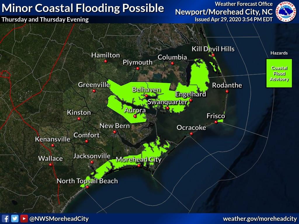
Minor soundside flooding with inundation of 1 to 2 feet above ground will be possible in areas vulnerable to southerly flow.