

This is what September looks like on the Outer Banks. North Carolina is now at the peak of hurricane season, and the tropics show it.
The National Hurricane Center is monitoring six systems in the Atlantic, including Tropical Storms Paulette and Rene.
Paulette is forecast to become a hurricane and will pass well to our east near Bermuda, but we are expected to see some possible impacts along the beaches early next week.
The tropical waves in the eastern Atlantic have the highest chances of formation into tropical depressions in the next five days.
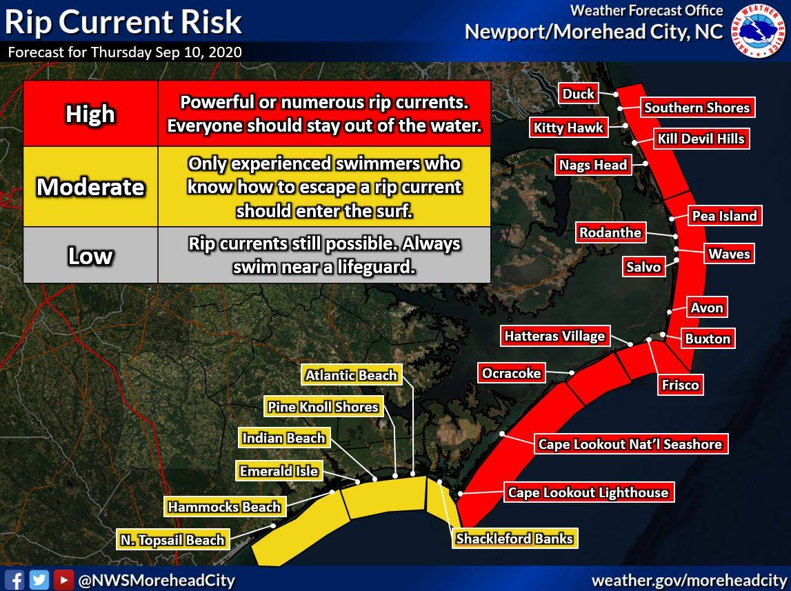
For the rest of today, heavy rain and a high risk of rip currents are expected across the Outer Banks as another low pressure system moves over the North Carolina coast.
That system is no longer forecast to become tropical as it moves on shore, and the hurricane center dropped it from its outlook map on Thursday afternoon.
Currituck County remains under a flash flood watch as widespread showers and scattered thunderstorms with heavy rain are expected to continue to move across the area.
The greatest threat for flash flooding will occur during the afternoon and evening. One two inches of rain is expected with locally higher amounts through this evening, said the National Weather Service Newport/Morehead City forecast office.
A beach hazards statement is in effect from Duck to Cape Lookout through this evening due to a high risk of rip currents.
A long period swell from Paulette next week is expected to produce possible ocean over wash and coastal flooding, along with rip currents.
Stay with OBXToday.com for the latest weather updates.