

While our part of the state avoided the worst of the severe weather yesterday, the Outer Banks is now being buffeted by strong northerly winds that could cause multiple issues on both the ocean and sound side.
A cold front will push through the area today. High pressure will build south over the area this weekend into early next week while low pressure slowly churns off of the southeast coast.
Dare County Emergency Management advised residents and visitors to closely monitor the weather over the few days, especially for coastal flooding, possible ocean overwash, beach erosion and hazardous marine conditions beginning today and lasting throughout the weekend.
“With the severe weather threat, everyone should ensure they have multiple ways to receive weather watches and warnings issued by the National Weather Service,” said Dare County Emergency Management Director Drew Pearson.
Along with OBX Today, we’ll have updates throughout the duration on Beach 104, Big 94.5 WCMS, 99.1 The Sound and News Talk 92.3 WZPR.
A NOAA Weather Radio, with fresh batteries, and a mobile device with alerts turned on are also recommended.
To receive the latest emergency alerts issued by Dare County, visit www.DareNC.com/Alerts to sign up for OBXAlerts for instant text and email notifications. Select the National Weather Service-issued “WARNINGS” and “WATCHES” list to receive these weather service products via OBXAlerts.
“To ensure you are able to take action when warnings are issued, keep your mobile device plugged in with the volume up and near your bed overnight,” Pearson said.
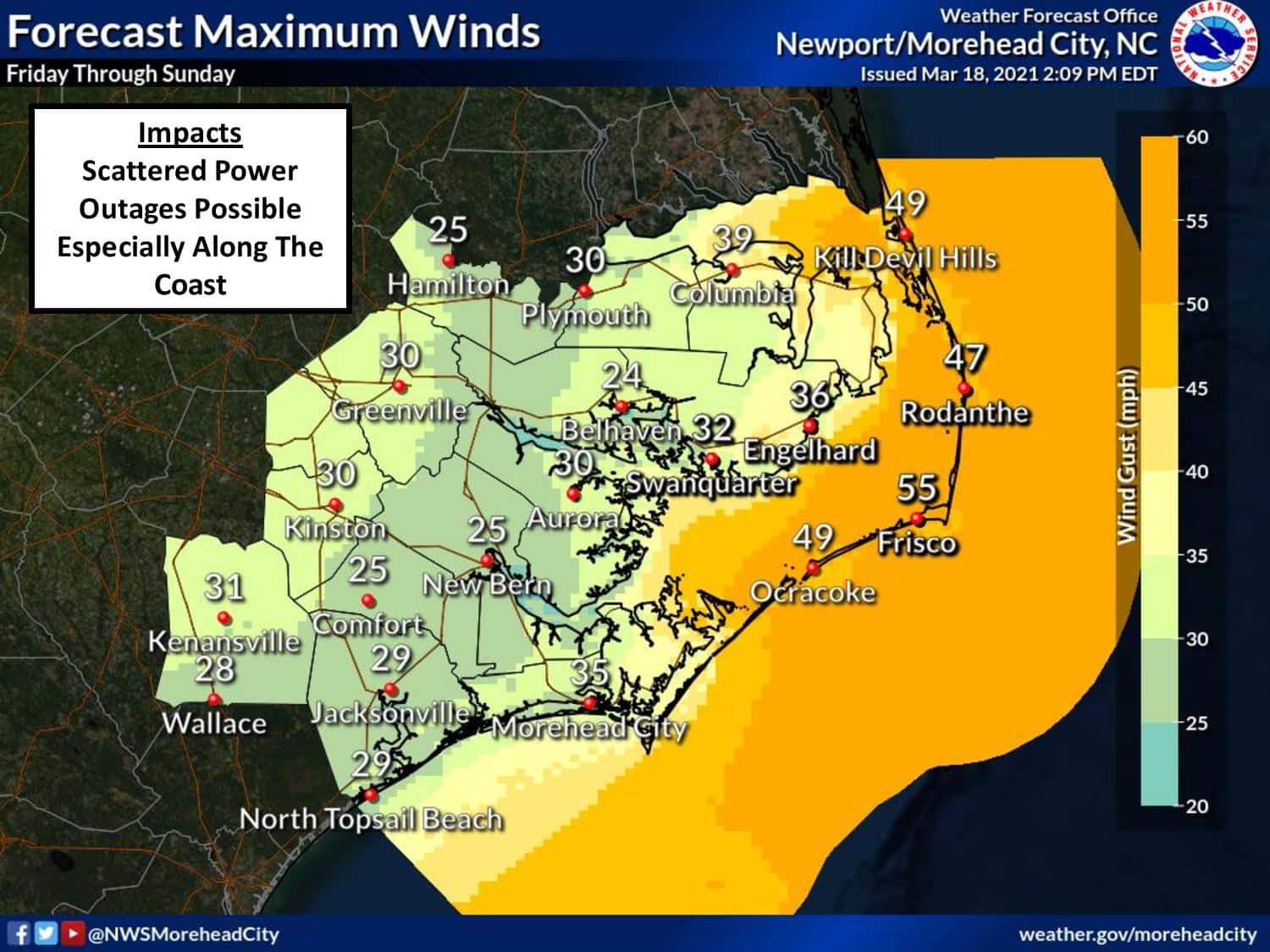

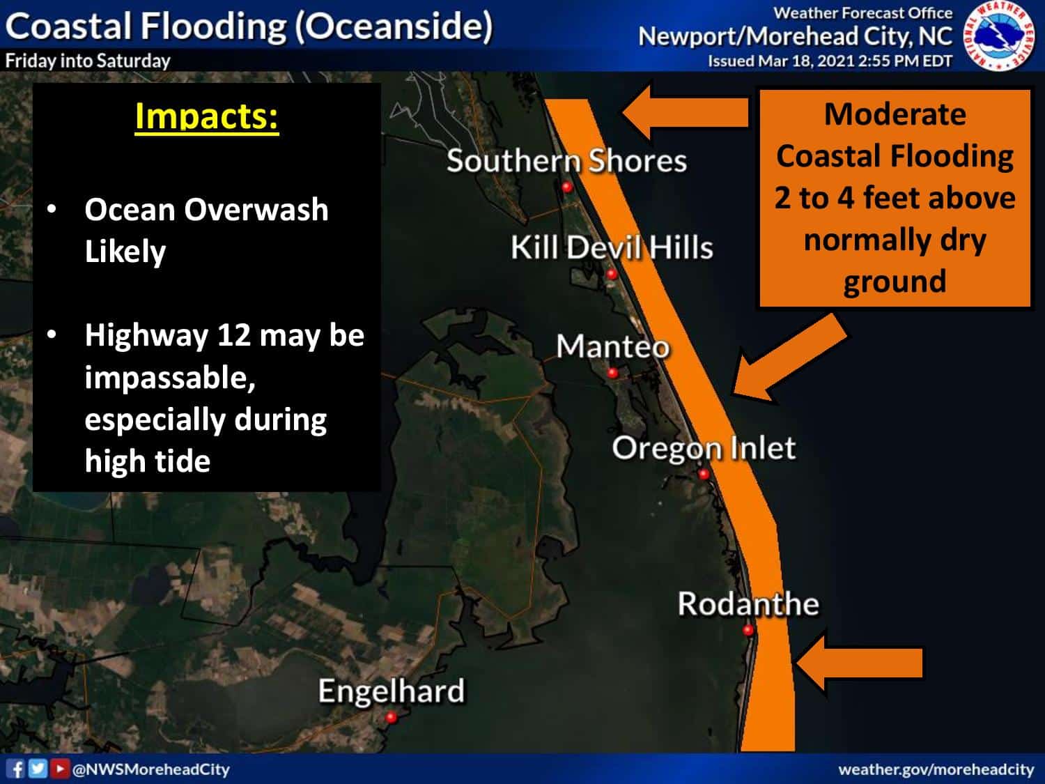
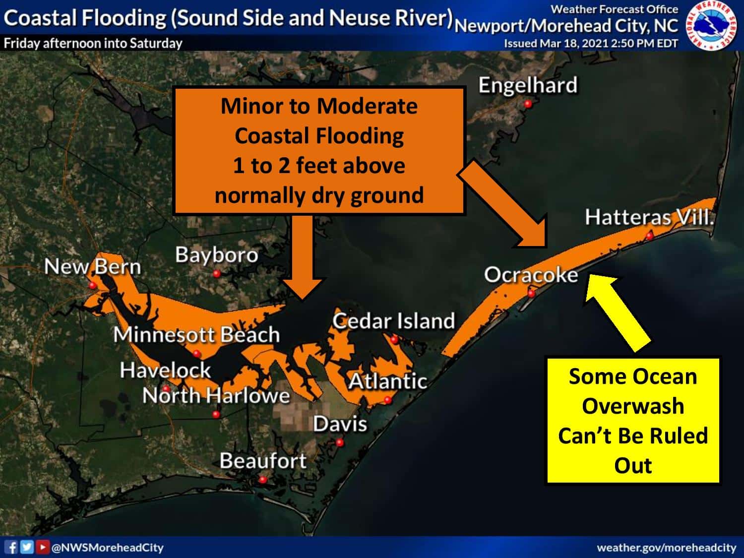
These strong winds could also lead to minor to moderate coastal flooding, with one to three feet of above-ground inundation for soundside portions of the Outer Banks and tidal tributaries possible, as well as ocean overwash across parts of the northern Outer Banks.
The National Weather Service has issued a coastal flood watch that is in effect through 5 a.m. on Saturday. A wind advisory and gale warning will also be in effect starting Friday morning.
For the most up-to-date weather information on this severe weather outbreak, visit the National Weather Service at Newport/Morehead City at www.weather.gov/mhx. For updated information regarding road conditions on N.C. Highway 12, follow the North Carolina Department of Transportation on Facebook at www.facebook/ncdot, on Twitter @NCDOTNC12 or visit drivenc.gov.
Beach driving suspended off Kill Devil Hills
Hazardous beach conditions have the potential to last more than several days. To protect Kill Devil Hills beaches, deter ocean over-wash, and protect property the Town will be closing drive-over beach accesses with barricades and sand pushes.
Closing beach accesses will be completed in the afternoon of March 18, and will remain closed to public beach driving until further notice.
The town will monitor beach conditions every day and take action to reopen the beaches for driving as soon as conditions are deemed safe.
Do not take risks with yourself, your vehicle, or with the lives of those that would be called to respond to a rescue situation. Beach conditions for the next several days are not going to be conducive to activities on the beach, especially beach driving.