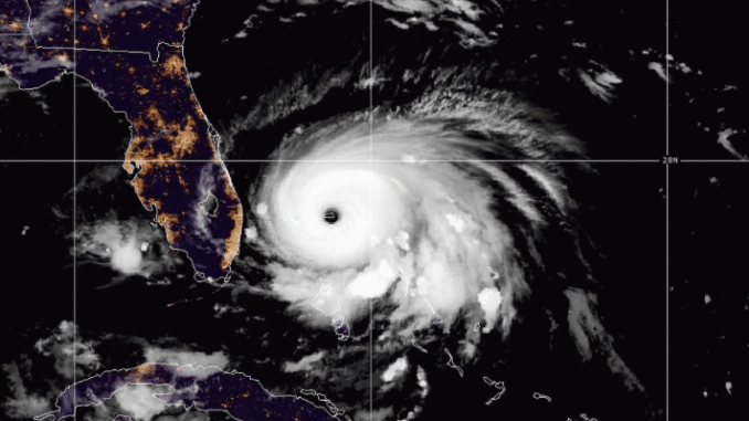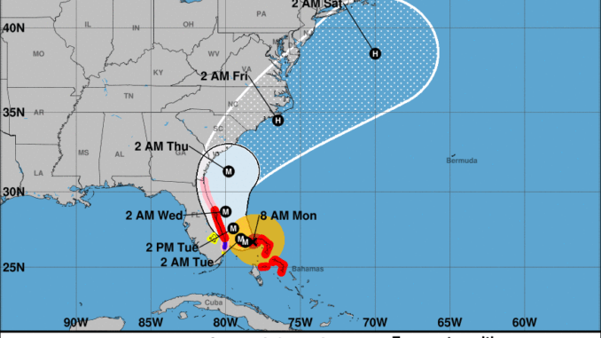
Hurricane Dorian remained a Category 5 hurricane Monday morning with sustained winds of 165 mph as the storm moved toward the southeast coast, with threats rising for the Outer Banks.

In the short term, dangerous ocean conditions will persist today and through the week for all Outer Banks beaches. Stay out of the water! There is a high risk for powerful or numerous rip currents, dangerous shore break and longshore currents.
Dorian is expected to crawl slowly west through Tuesday morning before making a turn to the north along the Florida east coast by Tuesday afternoon and Wednesday. Dorian is then expected to turn northeast and track off the Carolina coast by late in the coming week.
“There is still much uncertainty with respect to the exact track, but there is increasing potential for impacts to northeast North Carolina, eastern Virginia and southeast Maryland late in the week,” the National Weather Service Wakefield, Virginia office said in a briefing this morning.
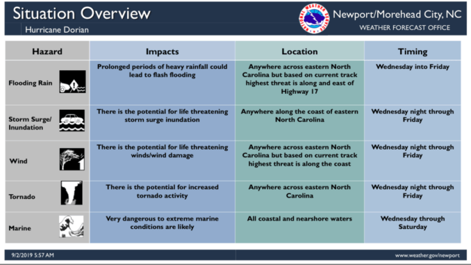
The Outer Banks will start feeling the wind and rain impacts of Hurricane Dorian as soon as Wednesday evening. The threat for prolonged periods of heavy rainfall, flash flooding, storm-surge inundation, wind damage and possible tornado activity continues to increase, the National Weather Service Newport/Morehead office said in a morning briefing. Five to 10 inches of rain is possible for eastern North Carolina, with isolated areas seeing as much as 15 inches.

Emergency management officials in Dare and Hyde counties will be meeting today to discuss next steps ahead of the storm, including evacuations. Evacuations are underway this morning along the coasts of Florida, Georgia and South Carolina.
The NWS says the most likely time of arrival for tropical storm force winds is sometime Thursday. However those winds could arrive as early as Wednesday night.
“All preparations should be completed by Wednesday,” the weather service said.
Related stories:
